A surf pilgrimage
This weekend Luke and I drove 500+ km down to Sennen Cove for our annual UK surf trip.
Over the past few years we’ve got into a bit a a lazy habit of just going as far as North Devon. This year we wanted to try something different and go somewhere new.
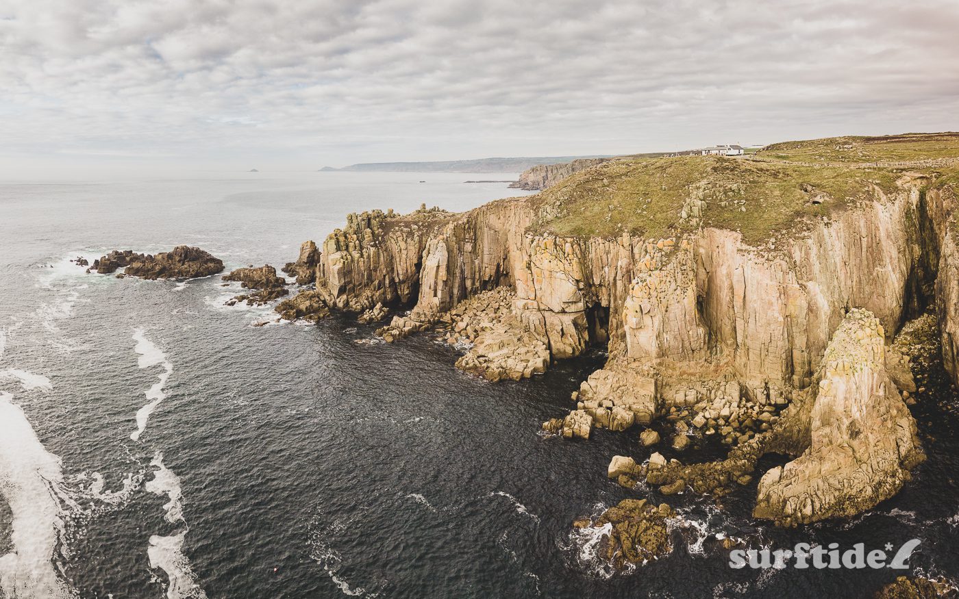
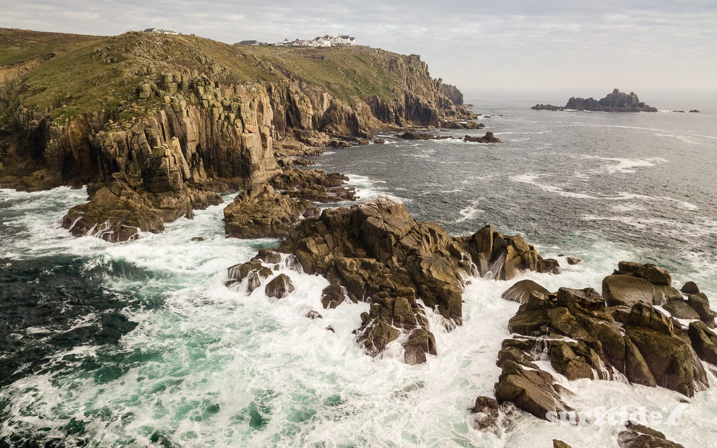
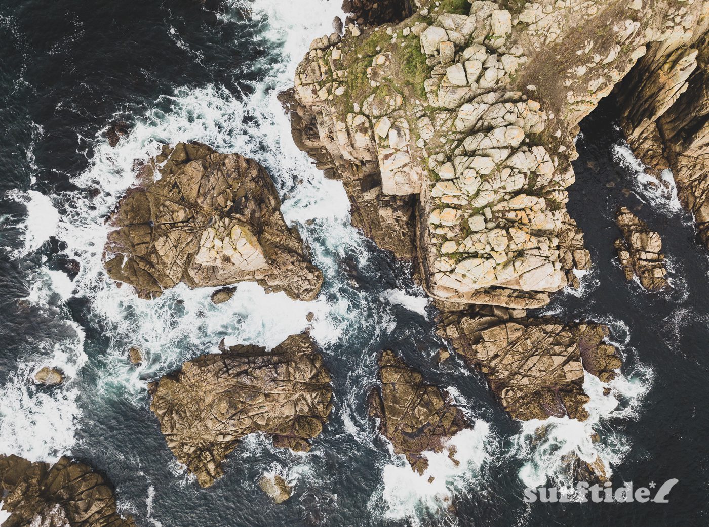
So we decided to go as far south and west as possible and stay in the small coastal village of Sennen, just a few miles from Land’s End.
A bit of a gamble
As is much the case when you travel anywhere to surf in the UK, it is a bit of a gamble.
This year was no different. We had a mixed bag of sunshine and some heavily overcast days. But we also bagged three days of offshore winds and clean surf from 2-5ft.
We managed to pack in about 10 hours in the water over three days, with our final day consisting of a three hour morning surf, a 10km round trip walk to Land’s End (and back) and a final hour in the surf in the evening.
Aerial photos
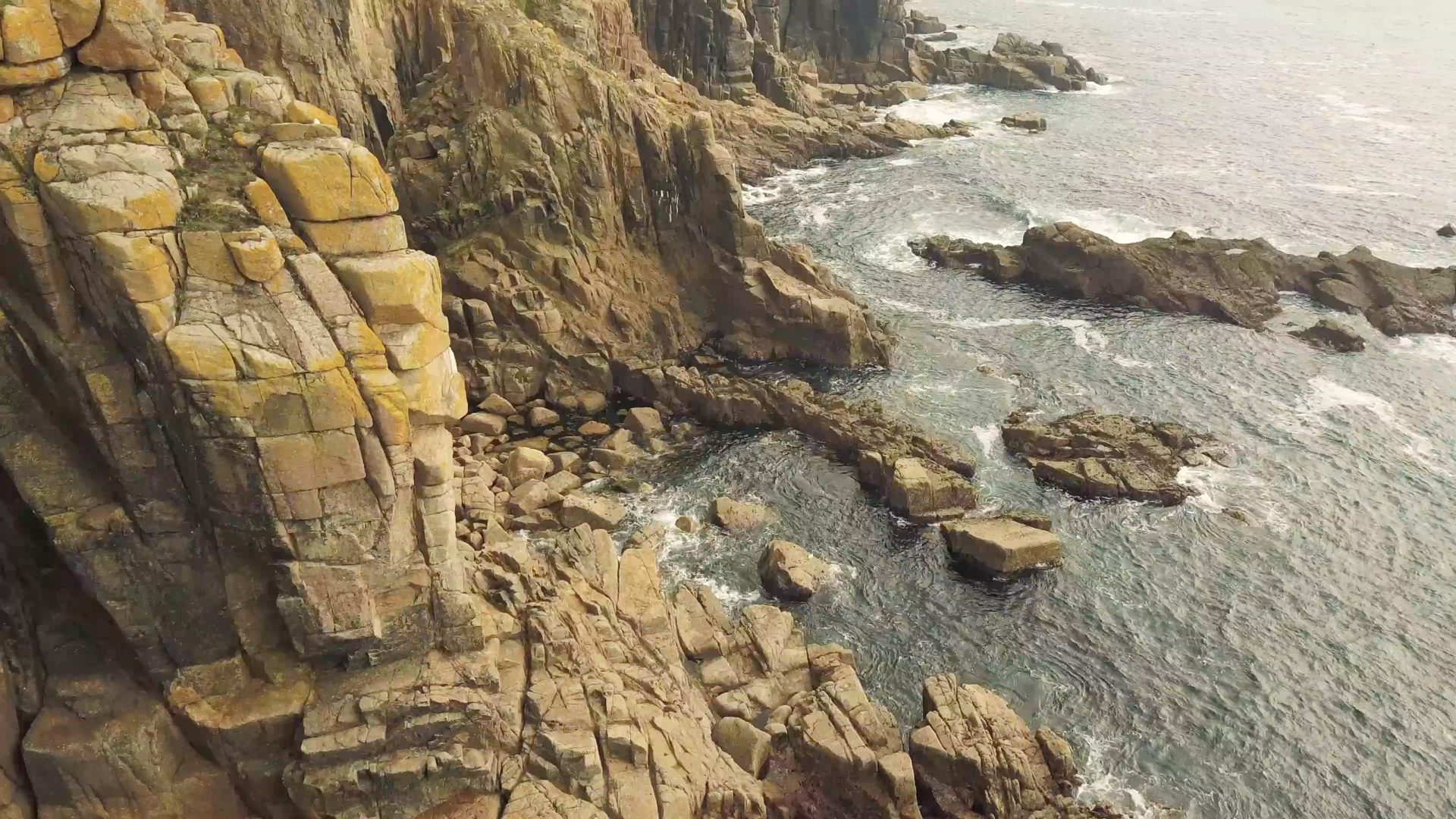
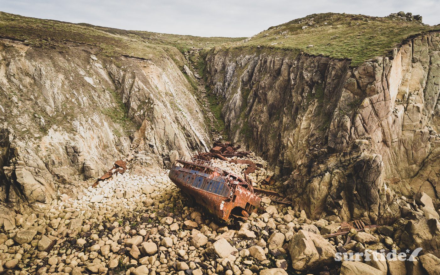
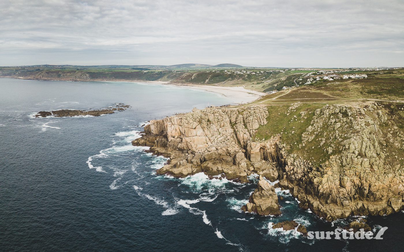
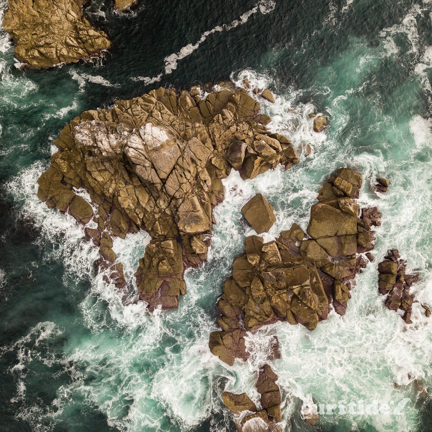
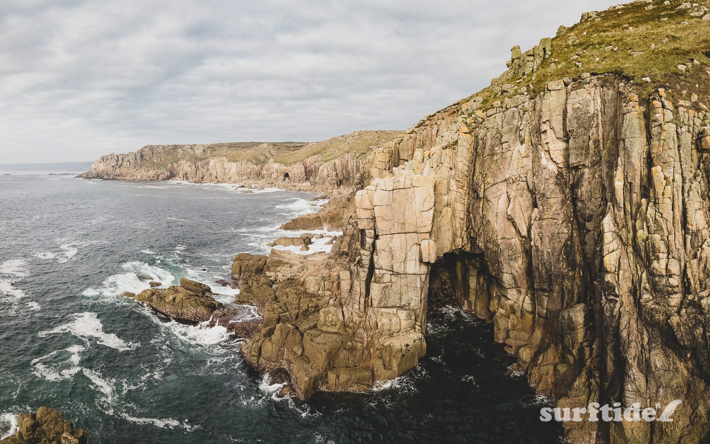
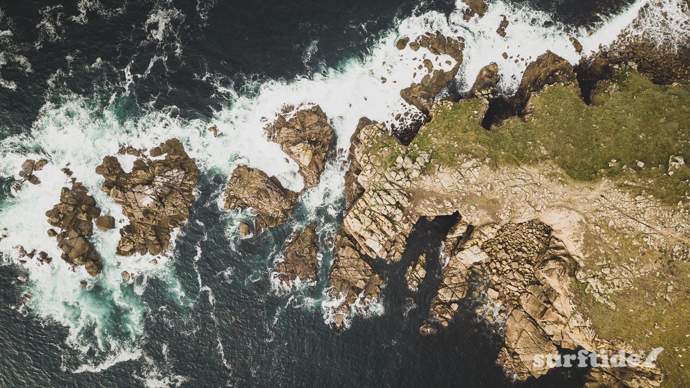
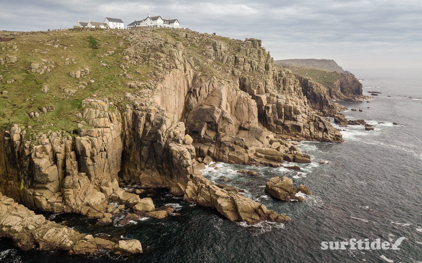
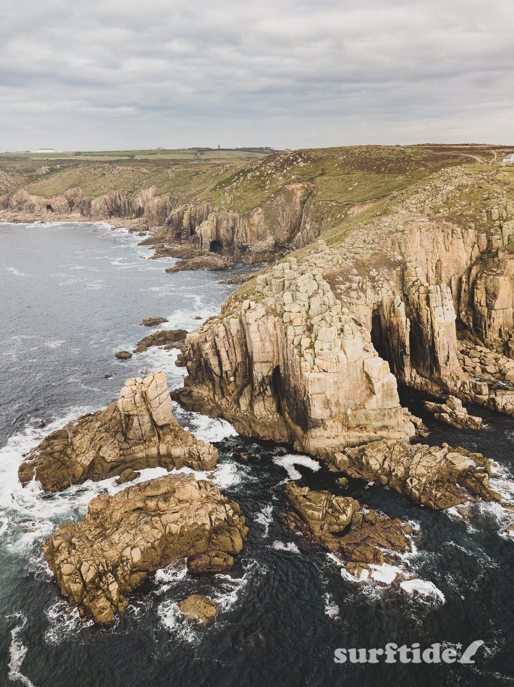
Below are some of the shots from our coastal walk to Land’s End. Shot on my Mavic Pro drone and edited in Adobe Lightroom.
The rusting remains of RMS Mulheim, a German cargo ship that was shipwrecked at Land’s End on 22 March 2003. Aerial view of Sennen Cove looking north east. Shot from the headland at Land’s End. You can see the South West Coastal Path and the beaches of Sennen & Gewnver in the distance. Shot using a DJI Mavic Pro Drone. An aerial view of the powerful waves crashing into the rocks just off the tip of Land’s End in South West Cornwall. One of the many magnificent coastal rock formations along the coastline at Land’s End, South West Cornwall. Shot using a DJI Mavic Pro Drone. An aerial view of the tip of Land’s End headland. Shot straight down to capture the energy and drama of this magnificent stretch of coastline in South West Cornwall. Shot using a DJI Mavic Pro Drone. A close-up view of the dramatic scenery at Land’s End in South West Cornwall. Shot using a DJI Mavic Pro Drone. Aerial view of Land’s End in South West Cornwall. Shot using a DJI Mavic Pro Drone just off the tip of the rocky headland. Aerial view of Land’s End, looking north from the headland, inland along the South West Coastal Path in South West Cornwall. Shot using a DJI Mavic Pro Drone. Aerial view of Land’s End, looking north east from the headland, inland along the South West Coastal Path in South West Cornwall. Shot using a DJI Mavic Pro Drone Aerial view of Land’s End, looking south from the headland, with the South West Coastal Path in the distance. Shot using a DJI Mavic Pro Drone